Setting & Character
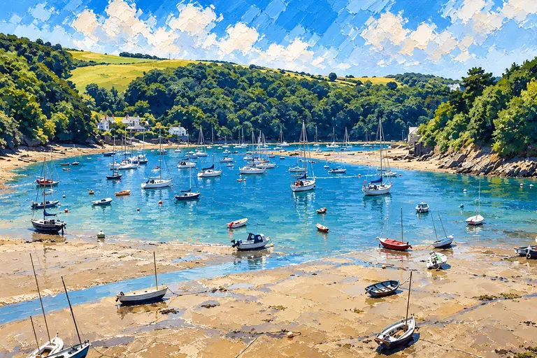
Salcombe sits in a steep wooded estuary opening to the Channel west of Start Point and Prawle. The town climbs above the waterfront; East Portlemouth faces it across the reach; further up, The Bag and the Kingsbridge stretch turn the harbour into a proper Devon river night. In high summer it is one of the busiest leisure harbours on the south coast.
Arrival by Sea
Use Admiralty charts 28 and 1613 (Guide 2026). The bar has a least depth of 0.5 m LAT — do not negotiate it on an ebb with strong onshore wind or swell. The entrance leading line is 000°T; the rear beacon Dir Fl WRG.2s has a white sector 357°–002°T. Once Blackstone Rock is abeam to starboard, the fairway runs 042°T on the transit lights near Scoble Point. Harbour pilotage pages and the Guide 2026 PDF are the references to keep open.
Call Salcombe Harbour on VHF Ch 14 for berthing advice. Speed limits are 6 or 8 knots (minimise wake). Vessels over 14 m should contact the Harbour Office in advance.
Berthing Experience
Visitors from the sea use swinging moorings and isolated pontoons. From-sea moorings generally cannot be pre-booked, except overnight or restricted-hours walk-ashore on Whitestrand (extra charge; typically about two vessels, 19:00–08:00, draught and tide dependent).
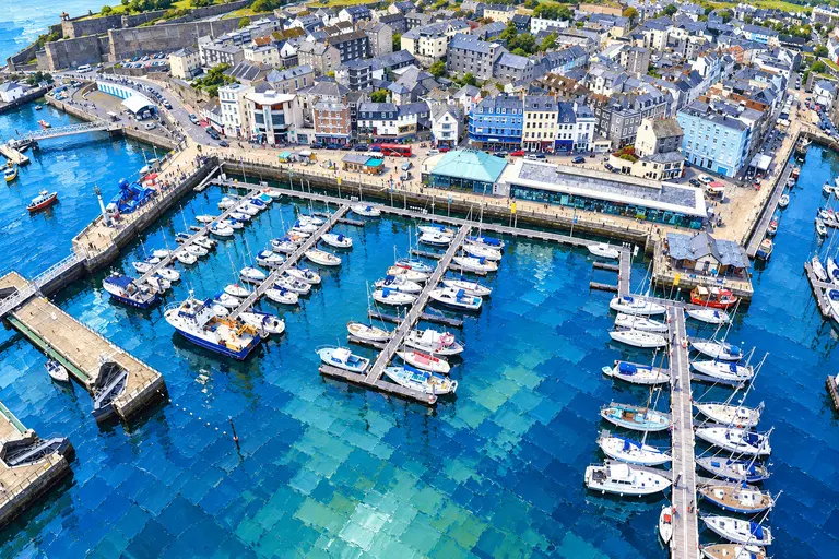
Visitor “V” buoys between Mill Bay and the Fuel Barge are orange up to 10 m LOA and yellow over 10 m. A large visitors’ pontoon with yellow pile caps lies in The Bag, northwest of Scoble Point. Anchoring is allowed off Town/Fishermans Beach and Smalls Cove (avoid the yacht-club start when in use), and further up near Saltstone north of The Bag — not in mid-fairway or ferry/cable crossings.
Normandy Pontoon (east side) is short-stay water and provisions — about half an hour at busy times. Tenders from sea visitors up to 3.65 m may use the west (shoreside) Normandy face, not overnight. Unattended overnight needs prior Harbour Master permission and is not guaranteed. Stays beyond 14 days without a break need the Harbour Office.
Kingsbridge, upriver, is a tide-planned hop — roughly 2½ hours either side of high water, for draft under about 2 m and LOA under about 11 m if prepared to take the ground. It is not available October–March; check the office. Fees and dues remain payable.
Visitor-from-sea charges (Salcombe Harbour Guide 2026, inc VAT; length rounded up to the nearest metre; overnight charged day by day with no weekly discount): anchorage year-round £1.15 per metre (harbour dues only). Moorings on swinging buoys and isolated pontoons (may be rafted) — 1 October–31 March £1.15 per metre (dues only); 1 April–31 May and 1 September–30 September £1.84 per metre (dues and discounted mooring); 1 June–31 August £2.30 per metre (dues and mooring). Alongside or walk-ashore when available, with no rafting, is an extra £1 per metre on top of the band above. Short-stay pricing is available — confirm the amount with the Harbour Office (Guide 2026 does not list the short-stay figure on the Visitors Charges page).
Facilities Afloat
Water and provisions runs use Normandy Pontoon on a short-stay basis. The harbour water taxi runs on VHF Ch 12 (07807 643879); Guide 2026 lists seasonal hours and per-person charges — confirm on the day. Batson Boat Park supports trailer and yard activity on published seasonal hours.
Marine Services
Diesel and petrol come from the Fuel Barge — VHF Channel 6, call sign Fuel Barge, telephone 07801 798862. Guide 2026 lists hours as seven days, 08:30–17:00, April–September. October–March hours are not stated in the Guide — call the barge or Harbour Office before relying on winter fuel.
Local yards, engineers and chandlery serve the estuary; confirm insurance (£3,000,000 third-party required by the Guide) and harbour requirements before arrival.
Ashore
Salcombe town has shops, pubs and restaurants above Whitestrand and along the steep streets. East Portlemouth and the ferry crossing are part of the harbour scene. Further up, The Bag and the Kingsbridge run are quieter once you leave the town reach.
Best For
A classic Devon estuary night west of Dartmouth.
- Crews hopping west from Dartmouth after Start Point / Prawle
- Skippers happy on swinging “V” buoys or The Bag pontoon
- Walk-ashore Whitestrand overnight when booked and tide allows
- A tide-aware run toward Kingsbridge in season
Less Suitable For
The bar, the crowds and the no-pre-book rule shape who it suits.
- Deep-draught arrivals planning to cross the bar on an ebb in onshore swell
- Skippers who need a guaranteed pre-booked town berth in August without Whitestrand arrangement
- Unattended overnight without prior Harbour Master permission
History & Local Character
Salcombe grew as a sheltered estuary port and later as one of the West Country’s favourite yacht harbours. The wooded banks, Whitestrand and the Bag still set the scene; Kingsbridge at the head of the navigation is a different, tide-critical outing.
Nearby Cruising
Dartmouth and Start Bay lie to the east; Plymouth Sound is the next major hop west. Prawle Point National Coastwatch (01548 511259 / VHF 65 per Guide useful numbers) watches the coastwise stretch.
Skipper's Notes
Bar, radio and Guide 2026 fees are the plan.
- Charts 28 & 1613; leading line 000°T; respect the 0.5 m LAT bar.
- Call Harbour Ch 14. Over 14 m — phone ahead.
- From-sea moorings are not pre-booked except Whitestrand overnight walk-ashore.
- Fuel barge Ch 6, Apr–Sep 08:30–17:00; winter hours — ask.
- HW Salcombe 05 h 23 min before Dover; use harbour tidal info + BBC + EasyTide.
Old Sea Dogs View
Salcombe is the Devon river postcard west of the Dart: wooded banks, a careful bar crossing, and supper ashore once you are on a “V” buoy under the town.
Tides & Weather
Guide 2026 gives HW Salcombe 05 h 23 min before Dover, with a maximum range of 5.7 m (mean springs about 4.7 m, mean neaps about 2.2 m). Use the harbour tidal-information page, BBC Salcombe tables and ADMIRALTY EasyTide rather than copied heights. The Harbour Office posts a daily weather note outside; NCI Prawle Point is on the coastwise stretch.
Information checked against official sources
The practical information in this Guide was checked against the source records below on 27 October 2026, including the Salcombe Harbour Guide 2026 PDF. Operational details can change — confirm with the harbour office before arrival.
- Salcombe Harbour Authority
- Salcombe Harbour — Contact
- Salcombe Harbour — Rates / charges
- Salcombe Harbour Guide 2026 (PDF)
- Salcombe Harbour — Pilotage
- Salcombe Harbour — Tidal information
- Salcombe Harbour — Fuel barge
- BBC / UKHO Salcombe tide tables
- ADMIRALTY EasyTide