Setting & Character
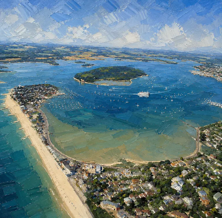
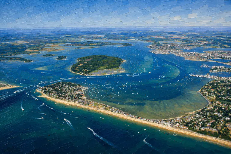
Hengistbury Head shelters the south side, the Mudeford sandbank with its beach huts lines the entrance, and the town rises at the top of the harbour. Inside you'll find salt marsh, reed beds and nature reserve. It is small-boat country: dinghies, day boats, fishing craft and shoal-draught cruisers.
Today the harbour is used mainly for leisure and fishing. Most of the harbour and its foreshore is a nature reserve and a designated SSSI, so expect birdlife, reed beds and quiet waters in place of quays and cranes.
Arrival by Sea
The bar outside The Run moves, sometimes dramatically, especially in winter. In fresh to strong winds from the south through south-east, a dangerous breaking swell can build on it. The Christchurch Harbour Association lays channel buoys in season, but they are a guide only, especially after heavy weather.
The tides are complicated, with double high waters and, on most days, four high waters every 25 hours. The sailing club advises that boats drawing about 1.1 metres should manage an hour either side of the higher of the two high waters. High pressure can take a foot or more off the depth. Two vertical green lights at the end of Mudeford Quay mark the inner end of the channel. BCP Council warns that The Run can be congested in summer and that the ebb reaches 8 knots.
There is about half an hour's difference between high water at the entrance and at the sailing club. Use current charts, the club's notes and local knowledge; on a first visit, timing is everything.
Berthing Experience
Christchurch Sailing Club has limited visitor berthing on the east side of its pontoon, and sometimes on the club wall in quiet periods, for a maximum of 48 hours. Monohulls under 10 metres from recognised clubs get priority. The 2026 rates are £22.50 under 7 metres, £29 for 7 to 9 metres and £35 for 9 to 11 metres, with a £12 lunchtime stop. The club is cashless. Call 01202 483150 first.
Strides boatyard (01425 540071, [email protected]) may have alternative berths. Boats may come alongside Mudeford Quay in The Run free of charge for up to two tides, keeping clear of the fishing boats and ferries. There is a public landing at Christchurch Quay, but watch for rocks on the riverbed at low water.
Limited anchoring is possible at the top of the harbour on the port-hand side, by the reed beds and clear of the fairway. Much of the harbour dries, and away from the channels the average depth is only about 46 cm.
Facilities
Facilities are those of Christchurch Sailing Club, which is cashless: pay berthing by card at the club office or bar. Check fuel and pump-out arrangements with the club or Strides before you arrive. There is a public landing at Christchurch Quay for crews going into town.
Ashore
Christchurch town and its quay lie at the head of the harbour. Mudeford Quay is a working quay known for crabbing, fresh fish stalls and a historic pub. The seasonal Mudeford Ferry crosses from the quay to the Mudeford Sandbank, with its beach huts and café, and on to Hengistbury Head nature reserve. It runs daily from April to late October and on winter weekends when the weather allows. Check ferry times and opening hours for the dates of your visit.
Best For
Bilge-keelers, lifting keels, motor boats and dinghies; crews comfortable with tide planning; a characterful stop between Poole and the western Solent.
Less Suitable For
Deep fin-keel yachts; any entry in fresh south to south-easterly winds or on the ebb; skippers wanting marina facilities and certainty of a berth.
Nearby Cruising
Poole Harbour and Studland Bay lie to the west, and Hurst Narrows opens the western Solent to the east, with Lymington and Yarmouth an easy next leg.
Skipper's Notes
Call the sailing club on 01202 483150 before setting out. Cross the bar around the higher high water, never in fresh south to south-easterly winds, and expect up to 8 knots on the ebb in The Run. Keep to 4 knots inside. Mudeford Quay is free for two tides; leave room for the fishing boats.
Old Sea Dogs View
Christchurch keeps its secrets for shallow boats and patient skippers. Get the tide right and it's one of the loveliest harbours on the coast.
Information checked against official sources
The practical information in this Guide was checked against the source records below on 21 October 2026. Operational details can change.
- Christchurch Sailing Club — Visiting CSC
- BCP Council — Christchurch Harbour approach and entrance
- BCP Council — Christchurch Harbour quayside access
- Mudeford Ferry — Visitor Information