Setting & Character
East Head is one of the last surviving stretches of natural coastline of its kind in West Sussex.
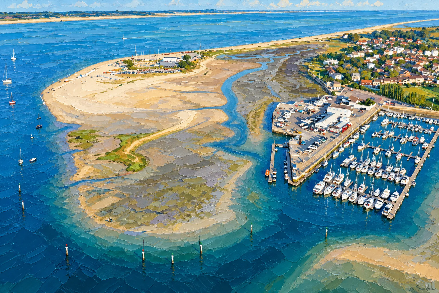
The National Trust describes a landscape of shifting sand dunes, shingle, beach, saltmarsh and flowing tidal water. The spit itself is naturally mobile rather than a fixed piece of coastline.
That gives the anchorage a very different feel from the marina stops elsewhere in Chichester Harbour.
There are no pontoons, electricity pedestals or shower blocks waiting beside the boat.
Instead there is a beach.
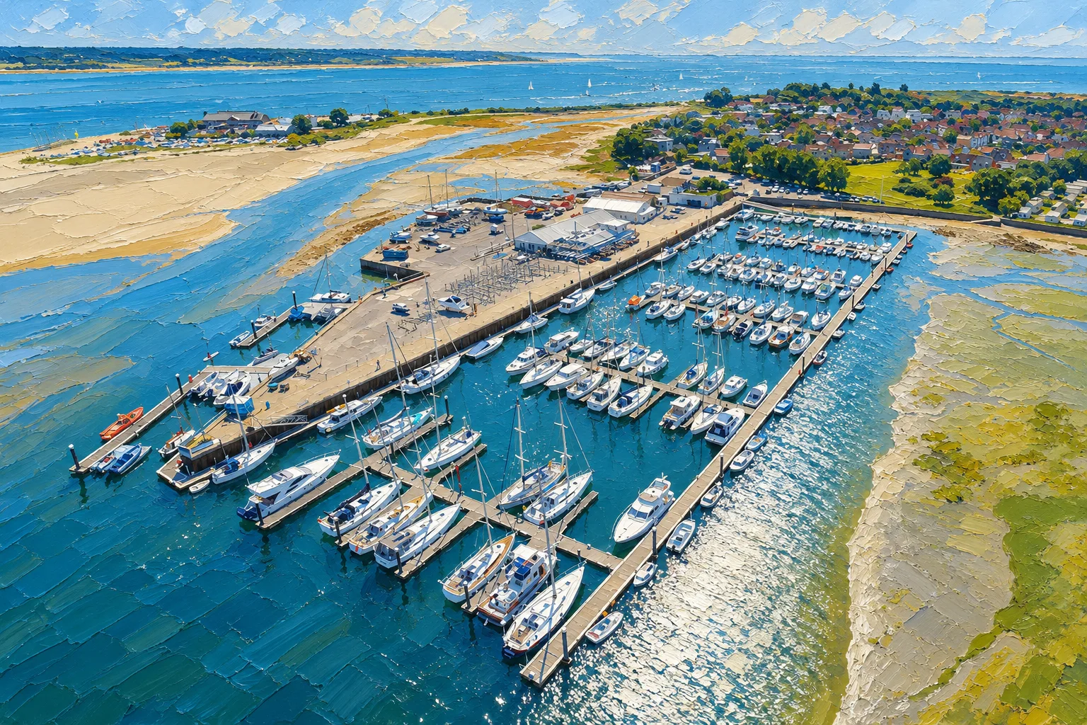
Behind it rise dunes covered with marram grass, while beyond the spit the harbour stretches north towards Itchenor, Bosham, Chichester and Emsworth.
Look west across the harbour entrance and Hayling Island forms the opposite shore.
At low water more of the surrounding sand and shallow ground reveals itself. At high water the harbour appears broader and the beach can feel remarkably close to a boat anchored in suitable depth.
The scenery is wonderfully simple.
The navigation is not.
Arrival by Sea
East Head sits immediately inside Chichester Harbour, which means the approach cannot sensibly be separated from the navigation of the harbour entrance.
Chichester Bar lies outside.
The Conservancy describes the Bar as a mobile feature whose position and depth can alter, particularly following severe weather. Ebb streams at the entrance can reach around six knots at springs, and strong southerly winds against a falling tide can produce dangerous conditions.
Current charts, tide information and Chichester Harbour Local Notices to Mariners therefore matter before heading for East Head.
Once inside, remain outside the main navigational channel before setting up for the anchorage.
The Conservancy defines the designated East Head anchorage as being south of a line between East Head Spit Buoy and Snowhill Buoy. Two unlighted starboard floating withies farther south indicate the Chart Datum contour.
Those marks and the current chart should be used as navigation information rather than attempting to follow a fixed waypoint printed in an old guide.
The coastline and seabed here are capable of changing.
Anchorage Experience
East Head is an anchorage rather than a mooring area.
Choose the position with consideration for:
- current depth - expected tidal range - swing - wind direction - tidal stream - surrounding vessels - the main navigation channel - sensitive seabed habitat.
The Conservancy specifically asks visiting boats to remain within recognised anchoring areas and to avoid anchoring on seabed vegetation such as seagrass.
Once anchored, a vessel must display an anchor ball by day and an anchor light at night.
The Harbour Authority also requires a proper and effective anchor watch and states that vessels must not be left unmanned at anchor for more than four hours.
Anchoring is prohibited in the centre of channels, around mooring areas and close to navigation or racing marks.
This is also a popular anchorage.
On fine summer weekends, leaving enough swinging room can be just as important as finding the desired depth.
Getting Ashore
The northern end of East Head is regularly visited by boat crews coming ashore from the anchorage.
The National Trust describes arriving by boat as a popular way of spending the day here.
A tender is therefore the normal answer for a cruising yacht anchored offshore.
There are no marina facilities waiting at the landing point, so everything needed for the trip ashore should come with you.
The National Trust particularly asks boat visitors to take their rubbish away because there are no litter bins at the northern end of East Head.
Strong currents and deep water occur around East Head, and there is no lifeguard presence. Swimming from the boat or beach therefore deserves considerably more thought than the sheltered appearance might suggest.
Secure the tender with the tide in mind.
The patch of beach that seemed comfortably above the water when you arrived may have other ideas later.
Ashore
East Head is wonderfully uncomplicated.
You have come for the beach, dunes, harbour views and walking.
The National Trust manages the site and describes it as one of the last surviving pieces of natural coastline in West Sussex.
A circular walk around East Head and Ellanore covers approximately four miles / 6.4 kilometres, taking in the beach, harbour and surrounding landscape. A different signed winter route operates during the colder months.
West Wittering lies beyond the dunes and beach, with broader visitor facilities farther along the shore.
Accessible public toilets are located between East Head and the West Wittering car park, approximately 15 minutes away on foot according to the National Trust.
Most yacht crews, however, will probably discover that sand, a picnic and a view back towards the boat are quite sufficient entertainment.
Wildlife & Conservation
East Head is beautiful partly because it remains a functioning natural habitat.
The dunes, beach, shingle, saltmarsh and mudflats support a wide range of wildlife.
Ringed plovers use shingle areas for nesting, while skylarks live in the dunes. The surrounding shore is also important for wintering and migratory birds including sanderlings and other waders.
The National Trust uses fenced or roped areas to protect sensitive bird habitat and asks visitors and dog owners to respect them.
The environmental responsibility begins before anyone reaches the beach.
Chichester Harbour contains important seagrass habitat, and the Conservancy asks sailors to anchor on bare seabed wherever possible, use the appropriate amount of chain and avoid unnecessary disturbance from dragging chain across sensitive areas.
Enjoying East Head and protecting it are the same job.
Best For
Crews wanting a night or lunch stop away from a marina.
Families looking for beach access directly from the boat.
Sailors who enjoy anchoring rather than always taking a berth.
Boats beginning or ending a cruise within Chichester Harbour.
Crews wanting easy access to one of the harbour’s most attractive natural destinations.
Visitors prepared to remain aboard or keep a proper anchor watch.
Less Suitable For
Crews who require shore power, showers or marina facilities.
Anyone uncomfortable anchoring in strongly tidal water.
Boats without appropriate anchoring equipment.
Visitors who want to leave the yacht unattended for a full day ashore.
Crews who have not checked current wind, tide and harbour conditions.
Skippers who regard dropping the anchor as the point at which navigation stops.
History & Local Character
East Head has been shaped far more by tide, wind and moving sediment than by buildings.
The Conservancy describes Chichester Harbour’s coastline as continuously changing as tidal movement, erosion and longshore drift move sand, mud, shingle and other material around the harbour.
Historic charts show particularly noticeable changes around East Head.
The National Trust has managed East Head since 1966, protecting a landscape that includes nationally rare sand-dune habitat.
That mobility is worth remembering when arriving by boat.
East Head is not a concrete harbour wall that will remain exactly where somebody drew it twenty years ago.
It is a living sand spit.
That is one reason current charts and harbour information matter so much here.
Nearby Cruising
Sparkes Marina lies nearby on the Hayling Island side of the harbour and provides fuel, visitor berths and marina facilities.
Itchenor lies farther inside Chichester Harbour and offers all-tide walk-ashore visitor berthing.
Bosham provides a classic tidal village destination.
Chichester Marina offers full marina and boatyard facilities behind its lock.
Northney Marina provides a quieter marina option farther up the western harbour.
Emsworth lies at the top of its tidal channel and provides a proper harbour-town stop.
For boats heading out of Chichester, the eastern Solent and Portsmouth lie west beyond the harbour entrance.
East Head therefore works particularly well as either the first stop after arriving in Chichester Harbour or the last night before heading back to sea.
Skipper's Notes
East Head may look relaxed, but it sits beside one of the most energetic pieces of water in the harbour.
Check Chichester Bar, wind and tide before arrival.
Use the designated East Head anchorage rather than dropping the hook wherever there appears to be spare water.
The Conservancy currently defines the anchorage as lying south of the line joining East Head Spit Buoy and Snowhill Buoy.
Stay out of the navigation channel and clear of navigation and racing marks.
Set the anchor properly rather than simply dropping enough chain to make the windlass stop complaining.
Allow sufficient swinging room.
Display the required anchor ball or light and maintain an effective anchor watch.
Do not leave the boat unmanned at anchor for more than four hours under current harbour rules.
Be particularly cautious about swimming. Strong tidal currents exist around East Head and the Harbour Authority specifically warns that swimming can be dangerous.
Finally, check the current Local Notices to Mariners. A separate prohibited anchoring area was in force within Chichester Channel during 2026 as part of habitat-restoration work, illustrating why current notices matter more than permanently printed restrictions.
Old Sea Dogs View
East Head is what happens when somebody asks a sailor what a marina really needs and the sailor replies, “Less marina.”
There are no pontoon numbers.
No electricity meter.
No shower code scribbled on the back of a receipt.
You find some suitable water, put the anchor down properly and sit in the cockpit looking at a beach.
It is difficult to improve on that.
Of course, Chichester Harbour makes you earn the simplicity.
The tide runs hard, the entrance is close and merely dropping a lump of metal over the bow does not qualify as anchoring. Set it properly, leave room for the neighbours and keep an eye on where the boat is going.
Then get the tender out.
Going ashore at East Head is one of those small pleasures that reminds you why the boat contains an inflatable dinghy that spends most of the year getting in everybody’s way.
Have a walk. Sit on the sand. Look back at the yacht.
Then return before the tide turns your tender journey into something worthy of a lifeboat report.
For us, East Head is one of Chichester Harbour’s essential stops.
Sometimes the best berth in the harbour does not have a pontoon attached to it.
Information checked against official sources
The practical information in this Guide has been checked against current information published by Chichester Harbour Conservancy and the National Trust.
Anchoring restrictions, navigation marks, environmental protection areas, Local Notices to Mariners, tidal conditions and harbour regulations can change. Current charts and Harbour Authority information should be checked before passage.
Verified facilities and information
Designated anchorage: East Head is one of three designated anchorages within Chichester Harbour.
Anchorage location: South of a line between East Head Spit Buoy and Snowhill Buoy.
Beach access by boat: The National Trust confirms that many visitors arrive by boat at the northern end of East Head.
Marina facilities: None at the anchorage.
Electricity: None.
Water: None at the anchorage.
Toilets: Facilities are located towards West Wittering, approximately 15 minutes' walk from East Head according to the National Trust.
Rubbish disposal: No litter bins at the northern end; visitors should take rubbish away.
Swimming: Strong tidal currents; no lifeguard presence. The Harbour Authority warns that swimming can be dangerous because of the strong tide.
Anchor signals: Anchor ball by day and anchor light at night.
Unattended vessel: Current Harbour Authority rule states that vessels must not be left unmanned at anchor for more than four hours.
Harbour dues: Payable by vessels entering or using Chichester Harbour under the Conservancy’s current charging rules.
Harbour VHF: Channel 14 — Chichester Harbour Patrol / Chichester Harbour Radio.
Harbour speed limit: 8 knots throughout Chichester Harbour.